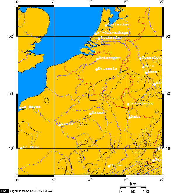
The software package OLAF was used for a numerical study concerning the location of an air polluting facility in the region of central Europe.
"Central Europe" is a rather vague term. We mean here a region roughly
encompassing the Benelux countries (Belgium, The Netherlands, and Luxembourg),
the western part of Germany, southeastern Britain, and northeastern France.
More precisely, the region used in this case study is a spherical rectangle
with the Greenwich meridian (![]() longitude) as it's eastern bound
and
longitude) as it's eastern bound
and ![]() E longitude as it's western boundary, while the latitude
coordinate runs from
E longitude as it's western boundary, while the latitude
coordinate runs from ![]() N to
N to ![]() N. This region has been
chosen given the availability of data needed by us, see Section 6.1 and
especially 6.1.3.
In Figure 6.1 and 6.2 (p.
N. This region has been
chosen given the availability of data needed by us, see Section 6.1 and
especially 6.1.3.
In Figure 6.1 and 6.2 (p. ![]() and
and ![]() ) the region under consideration is depicted (maps have
been produced with GMT (Generic Mapping Tools),
see [43]).
) the region under consideration is depicted (maps have
been produced with GMT (Generic Mapping Tools),
see [43]).

Figure 6.1: An overview of the modeled region and it's surroundings.

Figure 6.2: The modeled region.